
Puerto Rico Topological Regions
Puerto Rico is more than a collection of beaches and cities. The island's mountains, forests, rivers, limestone hills, and coastal plains have shaped where people settled, what they farmed, the traditions they developed, and the landscapes visitors experience today. Explore Puerto Rico through its major topographical regions to better understand the island's remarkable natural diversity.
Discover the five topological regions and what makes each region unique, from its landscapes and climate to its attractions and municipalities.
Note: Puerto Rico's topographical regions represent natural landscapes rather than administrative boundaries. Because many municipalities extend across mountains, valleys, coastal plains, or karst formations, some cities may appear in more than one region to reflect the diversity of their terrain.
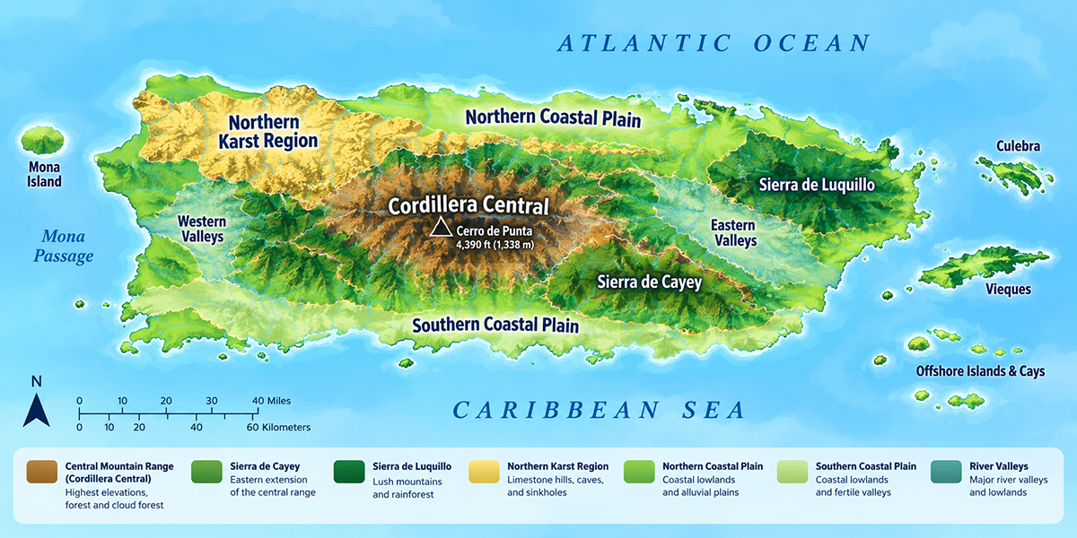
Overview
Cordillera Central (Central Mountain Range)
Northern Karst Region
Northern Coastal Plain
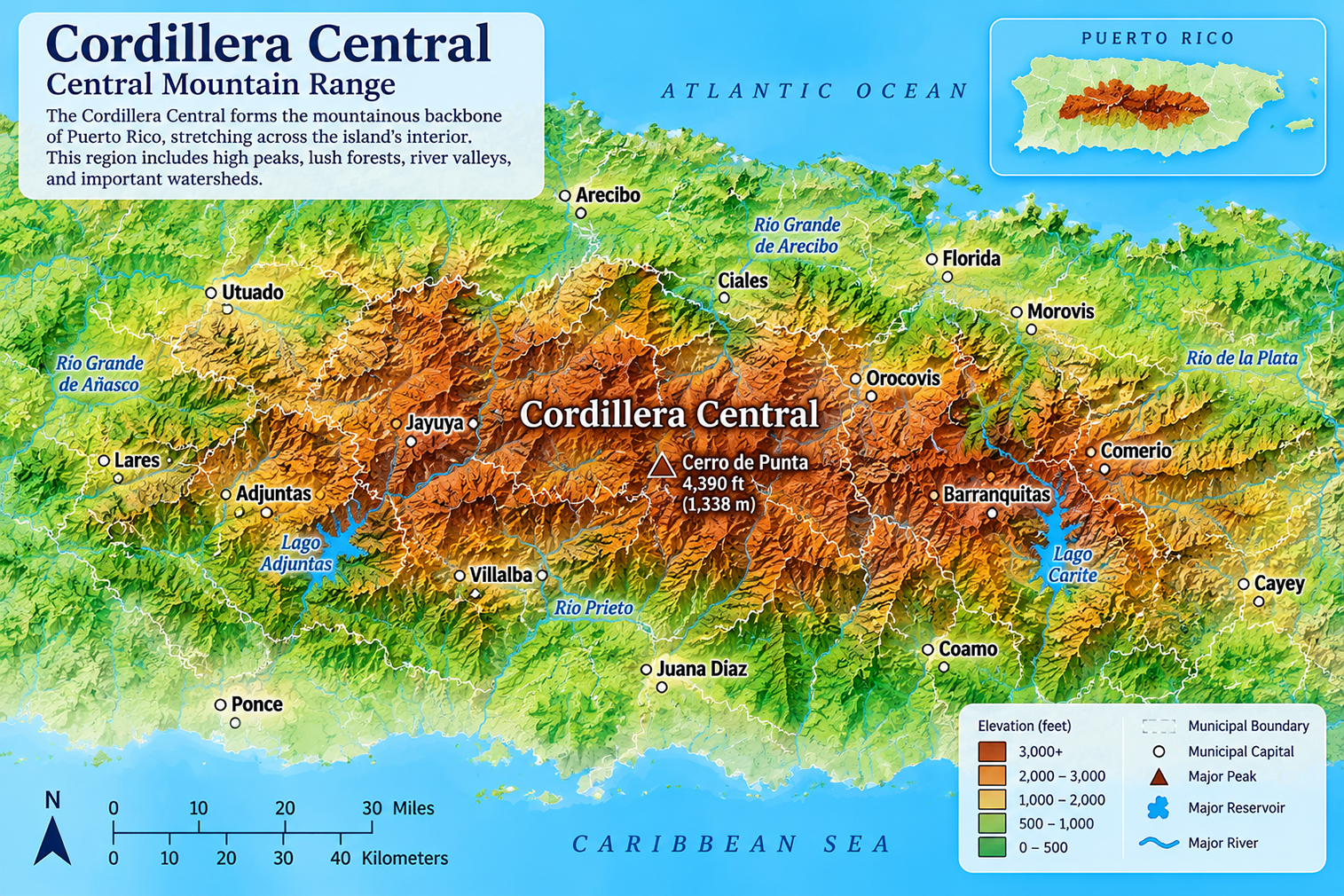
Cordillera Central (Central Mountain Range)
Puerto Rico's mountainous backbone, home to the island's highest peaks, coffee farms, waterfalls, scenic mountain roads, and cooler climate.
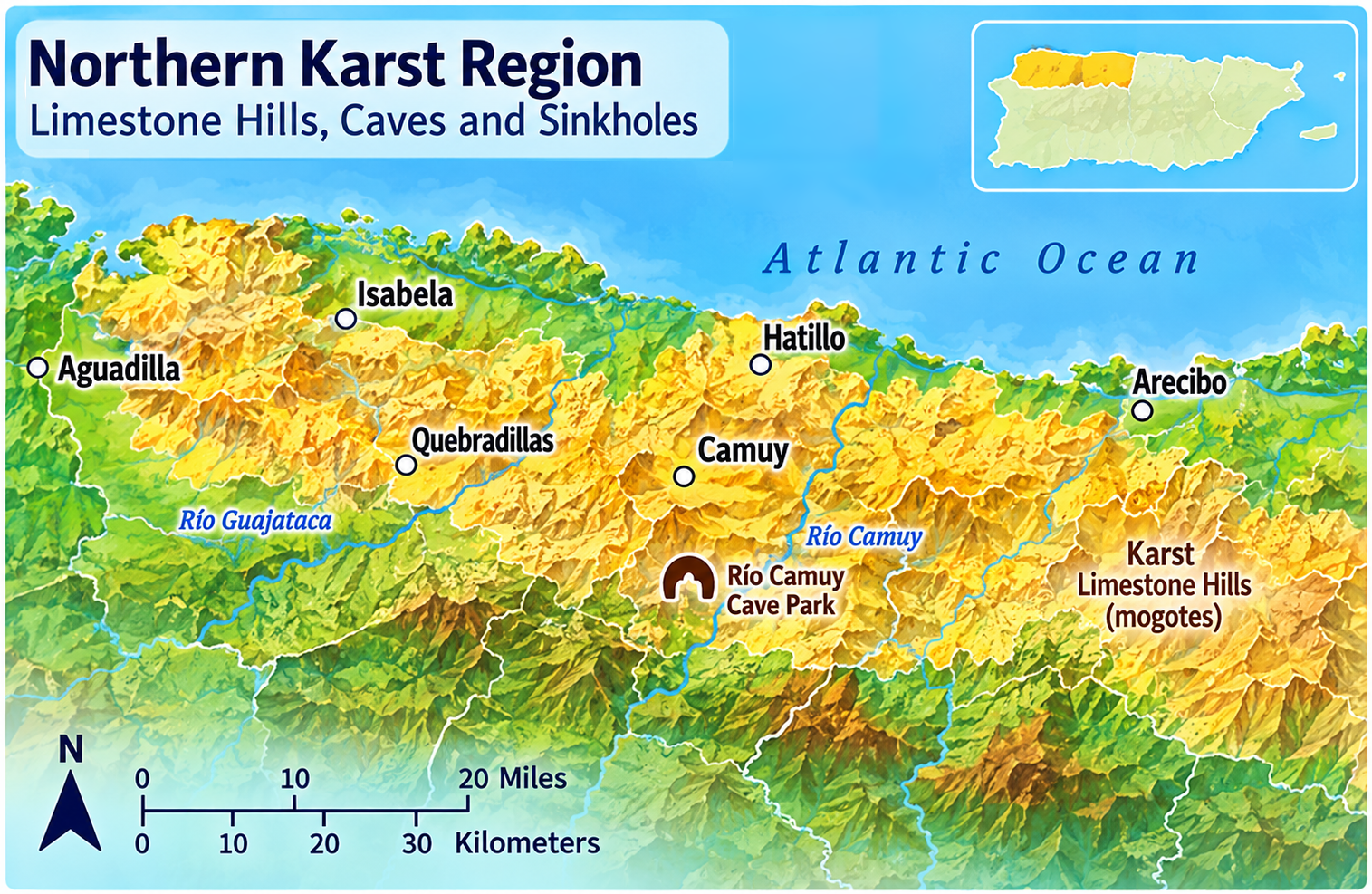
Northern Karst Region
A dramatic limestone landscape filled with caves, sinkholes, underground rivers, mogotes, and some of Puerto Rico's most unique ecosystems.
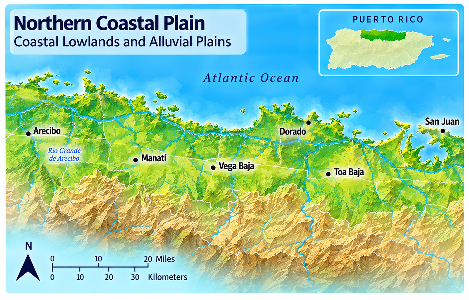
Northern Coastal Plain
Broad coastal lowlands featuring fertile farmland, major population centers, beaches, wetlands, estuaries, and important river systems.
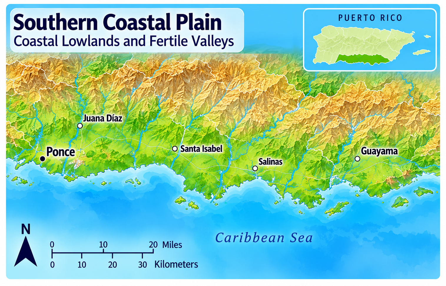
Southern Coastal Plain
A warmer, drier landscape known for open valleys, salt flats, wildlife refuges, historic towns, and agriculture adapted to a semi-arid climate.
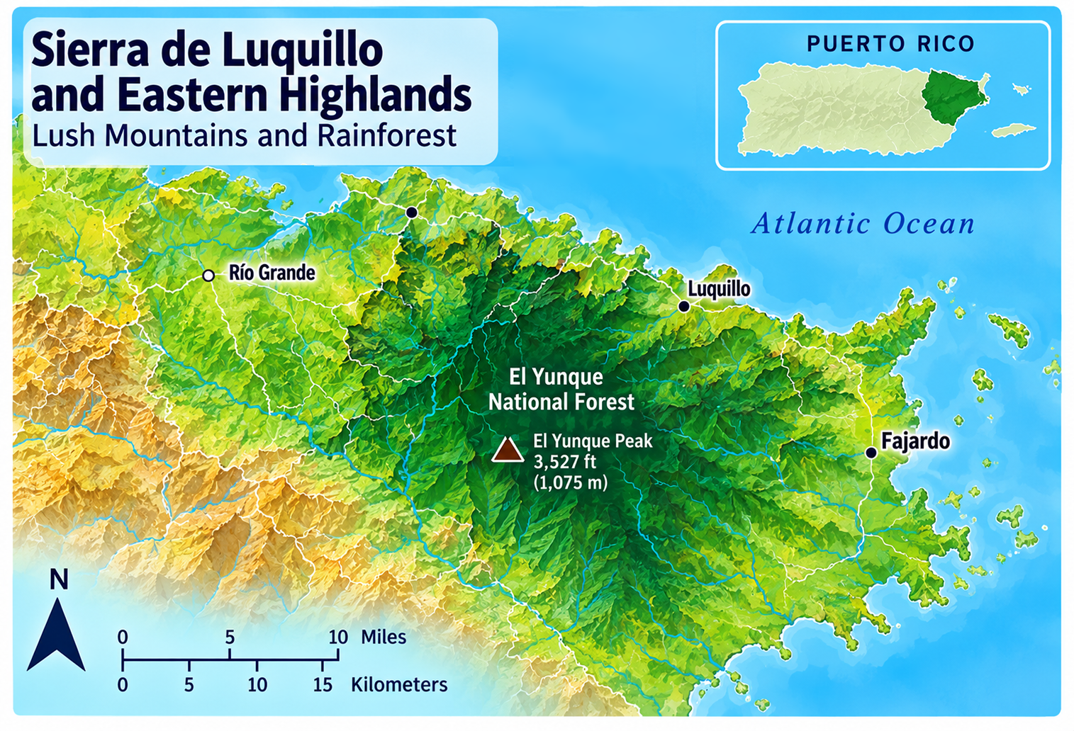
Sierra de Luquillo & Eastern Highlands
A lush mountain region dominated by El Yunque National Forest, abundant rainfall, rivers, waterfalls, and rich tropical biodiversity.
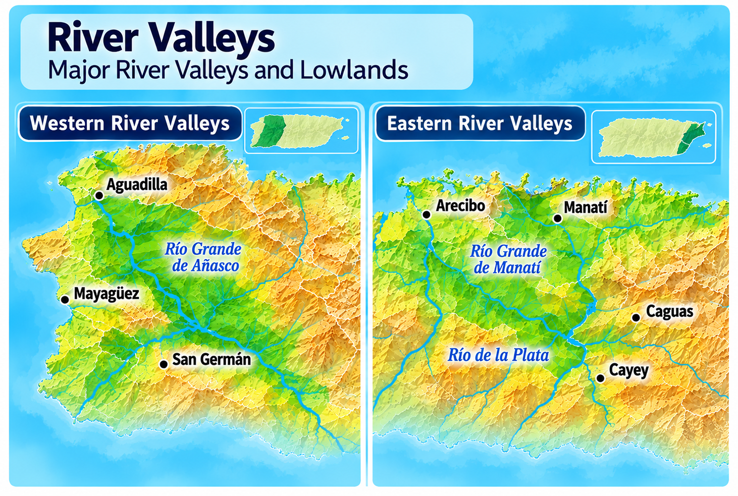
River Valleys
Fertile valleys carved by rivers flowing from the mountains, supporting agriculture, communities, scenic landscapes, and many of Puerto Rico's freshwater ecosystems.
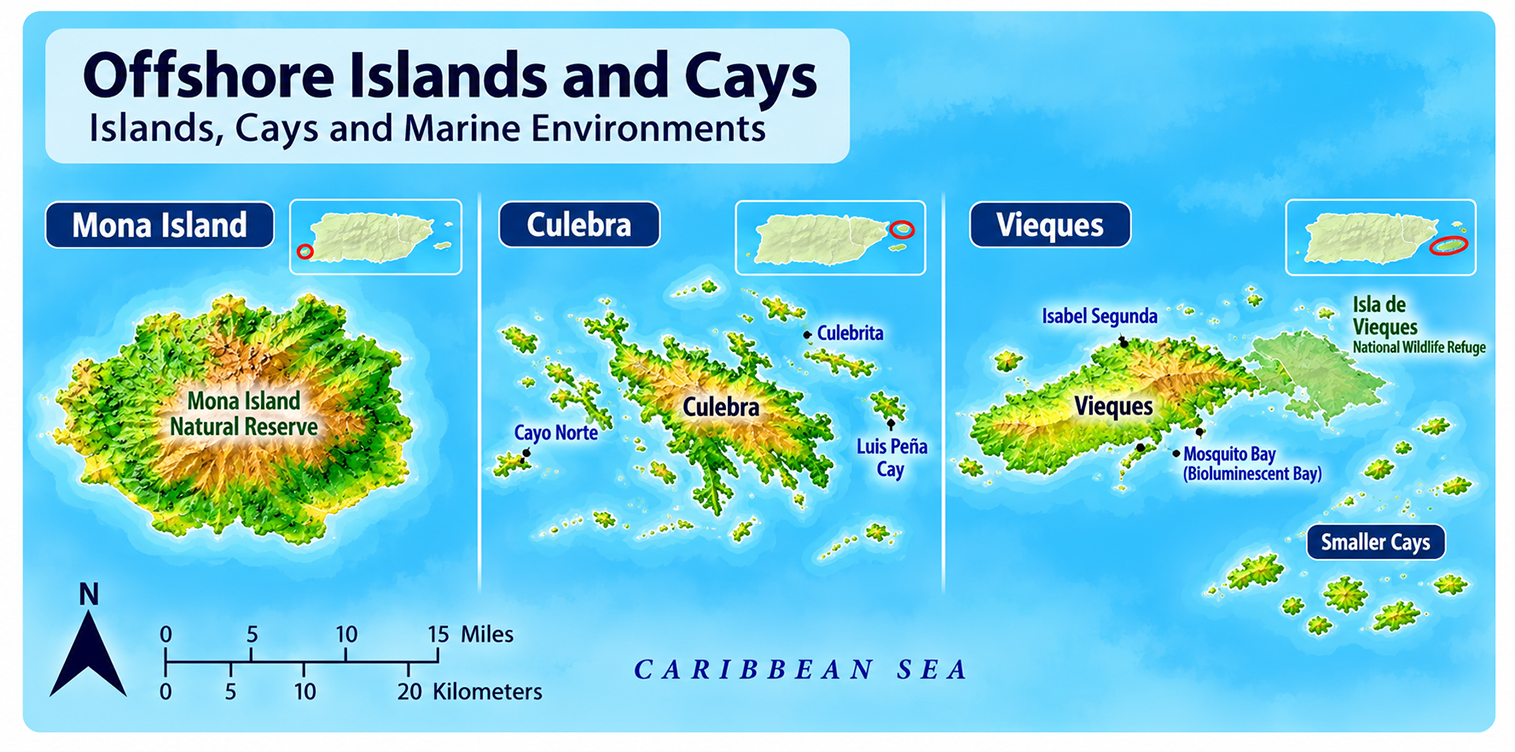
Offshore Islands & Cays
Small islands surrounding Puerto Rico that offer secluded beaches, coral reefs, wildlife refuges, historic sites, and some of the Caribbean's clearest waters.
Associated island groups
Caja de Muertos (Ponce)Mona (Mayagüez administrative region)
Monito
Desecheo
Culebrita (Culebra)
Landscape Systems (Occur Across Multiple Regions)
These aren't independent regions—they exist within or across the major regions.
Coastal Landscapes & Wetlands
Puerto Rico's diverse shoreline features sandy beaches, mangrove forests, coral reefs, estuaries, salt flats, sea cliffs, and sheltered bays that support rich marine ecosystems. Primarly found in: Cordillera Central, Northern Coastal Plain, and Southern Coastal Plain.
Western Coastal Lowlands
A broad coastal landscape of beaches, fertile valleys, fishing communities, wetlands, and some of Puerto Rico's most spectacular sunsets. Occurs around virtually the entire island (subregion of the Coastal Plain).
Wetlands & Mangroves
Found mainly along the coasts. Puerto Rico's coastal wetlands protect shorelines, filter water, provide wildlife habitat, and support important bird migrations.
Reservoirs & Lakes
Created within river basins, mostly in the mountains. Reservoirs supply drinking water, hydroelectric power, recreation, and irrigation. Most are located within Puerto Rico's mountain river systems.
Two Different Ways to Explore Puerto Rico
Puerto Rico can be divided in two different ways, depending on what you're exploring.
The tourism regions organize the island into areas that make planning a trip easier, grouping municipalities by attractions, culture, and visitor experiences.
The topographical regions describe Puerto Rico's natural landscapes, including mountain ranges, coastal plains, karst formations, river valleys, wetlands, and forests. These regions explain how the island was formed and why its climate, rivers, wildlife, agriculture, and communities differ from one place to another.
Note: Tourism regions, topographical regions, and electoral districts serve different purposes and should not be confused with one another.
Did You Know?
Castillo San Cristóbal is the largest Spanish fort built in the Americas.
Get Our Newsletter
Discover new places, local flavors, upcoming events, cultural stories, and some of our favorite finds from around the island.Read the Latest ¡La Isla! Newsletter
Follow Along


