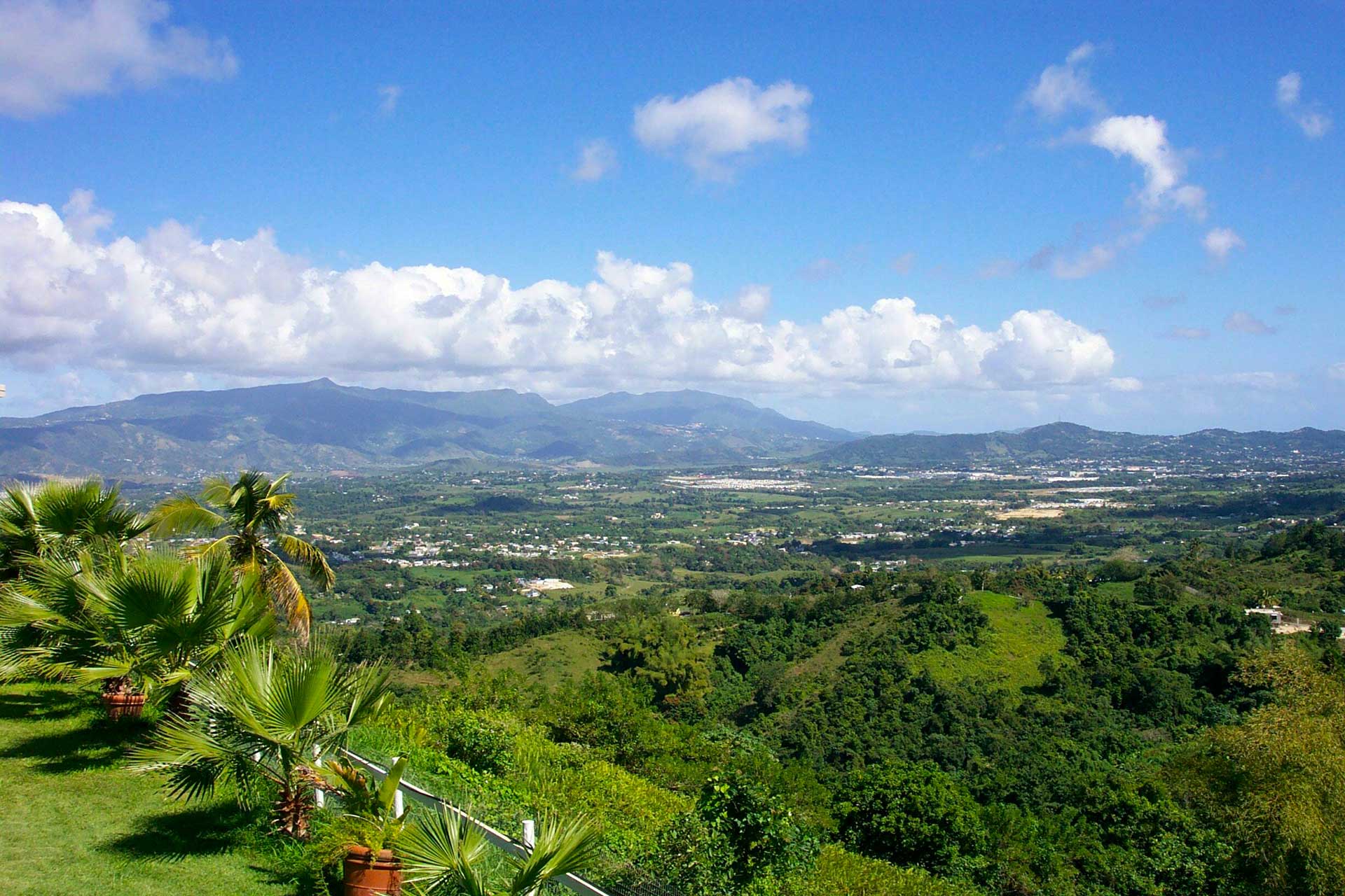
Las Piedras, Puerto Rico
(lahs pee-AI-drahs)
Las Piedras known as "La Ciudad de los Artesanos" (artesian city). Las Piedras was founded in 1773.
Las Piedras is located in the center region of the island, north of Yabucoa; south of Canóvanas and Río Grande; east of Juncos and San Lorenzo; and west of Naguabo and Humacao.
Las Piedras is made up of 8 barrios (PDF) (wards/districts):
- Arenas
- Boquerón
- Ceiba
- Collores
- Montones
- Pueblo
- Quebrada
- Tejas
Restaurants
- Guadalupita (Mexican), (787) 733-2735
- Los Compadres (Mexican), (787) 716-0360
Accommodations
- Casa de Loma (Rental),
603-622-0736
Festivals and Events
- Festival del Guiro - March
- Festival del Lechon Asao - November
- Festival Tipico - September
- Festival Tipico Cultural - April
- Fiestas de Cruz - May
- Fiestas de la Juventud - July
-
Fiestas Patronales Nuestra Senora de Asuncion
- December
Every year, Las Piedras celebrates a patron saint festival. The festivities include dances, food, parades and religious processions.(787) 733-8182
Displaying 7 results.
Symbols
Anthem: Somos de la Ribera...
Education
There are 14 public schools in Las Piedras, education is handled by the Puerto Rico Department of Education.
Climate
10 Day Forecast from weather.com
Demographics *
Population
35,180
Land Area: 33.88 sq mi
Density: 1,099 per sq mi
Median Age: 41.1
Sex: 52% female
Economics **
$12,093
Median household income: $22,848
Puerto Rico: $21,058
Persons below poverty line: 37.8%
Housing, families and educational attainment *
Number of households
12,143
Housing units density:
479.6 (2013)
Persons per household: 3.06
High school grad or higher: 78.8%
Marital status: 41% married
* U.S. Census Bureau 2020 data, unless otherwise noted - Source: Quick Facts Puerto Rico.
** U.S. Census Bureau 2016-2020
Map References
Coordinates: 18.1831° N, 65.8664° W
ZIP Code: 771
Driving Distance from San Juan: 28.1 miles
Driving Time: 59 minutes
Did You Know?
El Yunque receives over 150 inches of rain annually in some locations.
This is your comprehensive guide to La Isla del Encanto.