Villalba, Puerto Rico
(vee-YAHL-bah)
Villalba is known as "La Ciudad del Gandul" (pigeon pea city) and "La Ciudad de los Lagos" (city of lakes). Villalba was founded in 1917 by José R. Figueroa and Walter Mac K. Jones.
Villalba is located in the central region, northeast of Juana Díaz; south of Orocovis; and west of Coamo.
The surrounding areas produces green pigeon pees and coffee.
There are many well-known "villalbeños", among them: Virgilio Negron, Agustin Burgos, Carmen Suarez, Maximino Miranda, Welter K. Jones, and Bernardo Negron.
Villaba is made up of 7 barrios (wards/districts):
- Caonillas Abajo
- Caonillas Arriba
- Hato Puerco Arriba
- Pueblo
- Vacas
- Villalba Abajo
- Villalba Arriba
Restaurants
- El Patio Restaurant (Puerto Rican), (787) 847-7742
- Valle Verde Restaurant (Puerto Rican), (787) 847-6525
Festivals and Events
- Festival Areyto - November
-
Fiestas Patronales de Nuestra Sra. del Carmen
- July
Every year, Villalba celebrates a patron saint festival. The festivities include dances, food, parades and religious processions.(787) 847-2500
- Maraton Carlos Baez - December
Displaying 3 results.
Symbols
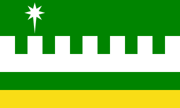
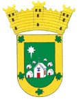
Anthem: A las orillas del Río Jacaguas...
Education
There are 14 public schools in Villalba, education is handled by the Puerto Rico Department of Education.
Climate
10 Day Forecast from weather.com
Demographics *
Population
22,093
Land Area: 35.64 sq mi
Density: 614.5 per sq mi
Median Age: 41.3
Sex: 52% female
Economics **
$11,596
Median household income: $19,355
Puerto Rico: $21,058
Persons below poverty line: 46.4%
Housing, families and educational attainment *
Number of households
7,932
Housing units density:
272.4 (2013)
Persons per household: 2.75
High school grad or higher: 78.5%
Marital status: 38% married
* U.S. Census Bureau 2020 data, unless otherwise noted - Source: Quick Facts Puerto Rico.
** U.S. Census Bureau 2016-2020
Map References
Coordinates: 18.1272° N, 66.4922° W
ZIP Code: 766
Driving Distance from San Juan: 76.1 miles
Driving Time: 1 hour, 52 minutes
Did You Know?
Contrary to popular belief the Puerto Rican flag is not based on the American Flag, but the Cuban flag. Puerto Rico adopted the same flag design, which was unveiled in 1895. In 1952, the blue field was changed from a light blue to a darker blue, like the American flag.
This is your comprehensive guide to La Isla del Encanto.