Lajas, Puerto Rico
(LAH-huz)
Located on Puerto Rico's scenic southwest coast, Lajas is best known for La Parguera, a picturesque seaside village famous for its bioluminescent bay, mangrove cays, crystal-clear waters, and spectacular sunsets. While much of Puerto Rico's southwest is known for beaches, Lajas offers a different experience—one centered around boating, kayaking, snorkeling, seafood, and nature.
Founded in 1883, Lajas is nicknamed "La Ciudad Cardenalicia" (The Cardinal City) and combines a rich agricultural heritage with one of Puerto Rico's most vibrant coastal communities. Whether you're exploring nearby cays, enjoying fresh seafood along the waterfront, or watching the bay glow beneath the stars, Lajas offers one of the island's most memorable outdoor experiences.
Overview
Why Visit Lajas?
Lajas is one of Puerto Rico's premier destinations for outdoor recreation and marine adventures. Unlike the island's surfing beaches, the calm waters around La Parguera are perfect for kayaking, paddleboarding, snorkeling, diving, sailing, and island hopping.
The municipality is also home to one of the world's few bioluminescent bays, where microscopic organisms illuminate the water with every movement, creating an unforgettable nighttime experience.
Why I Love Lajas
Lajas has always felt like one of Puerto Rico's hidden treasures. There's something magical about ending the day in La Parguera, watching the boats return to the dock as the sun sets over the mangroves. Whether you're kayaking through the bioluminescent bay, enjoying fresh seafood by the water, or simply taking in the relaxed pace of the town, Lajas reminds me that some of Puerto Rico's best experiences happen away from the crowds. It's a place where nature, history, and local culture come together beautifully.
Top Attractions in Lajas
La Parguera
The heart of Lajas, this lively waterfront village offers restaurants, bars, boat tours, gift shops, fishing charters, and one of Puerto Rico's best sunset views. It's the gateway to the area's famous cays and bioluminescent bay.
Bioluminescent Bay
One of only a handful of bioluminescent bays in the world, Bahía Bioluminiscente de La Parguera glows at night thanks to millions of microscopic dinoflagellates. Guided boat, kayak, and electric boat tours allow visitors to witness this remarkable natural phenomenon.
Mata La Gata
A beautiful mangrove cay featuring shallow turquoise water, picnic facilities, walking trails, observation towers, and snorkeling. It's one of the most popular day trips from La Parguera.
Caracoles Cay
One of Puerto Rico's most famous sandbars, Caracoles attracts boaters looking to relax in crystal-clear water. During weekends and holidays, it becomes a lively gathering place.
Cayo Enrique
A quieter alternative to Caracoles, Cayo Enrique offers calm waters, snorkeling, and excellent opportunities for birdwatching.
Isla Magueyes
Home to the University of Puerto Rico's Marine Sciences Laboratory, this small island has played an important role in marine research throughout the Caribbean.
Papayo Divers Marine Center
One of Puerto Rico's top diving operators, offering scuba diving, snorkeling excursions, certification courses, and trips to nearby coral reefs.
Plan your Visit
Everything you need to know before exploring Lajas and La Parguera.
Getting There
By Air
Luis Muñoz Marín International Airport (SJU) is about 2½ hours away.
Rafael Hernández Airport (BQN) in Aguadilla is approximately 1½ hours away.
Mercedita Airport (PSE) in Ponce is about one hour away.
By Car
Lajas is easily reached via PR-2, PR-100, and PR-304. A rental car is highly recommended.
Entry Requirements
As a U.S. territory, Puerto Rico requires no passport for U.S. citizens — a government-issued ID suffices. International visitors follow standard U.S. entry requirements.
Getting Around
Rental Car
The easiest way to explore beaches, La Parguera, and surrounding attractions.
Boat Tours
Most attractions—including Mata La Gata, Caracoles, and the Bioluminescent Bay—are only accessible by boat.
Kayaking
One of the most popular ways to experience the glowing waters at night.
Walking
La Parguera's waterfront is compact and easily explored on foot.
Nature & Resources
Geography
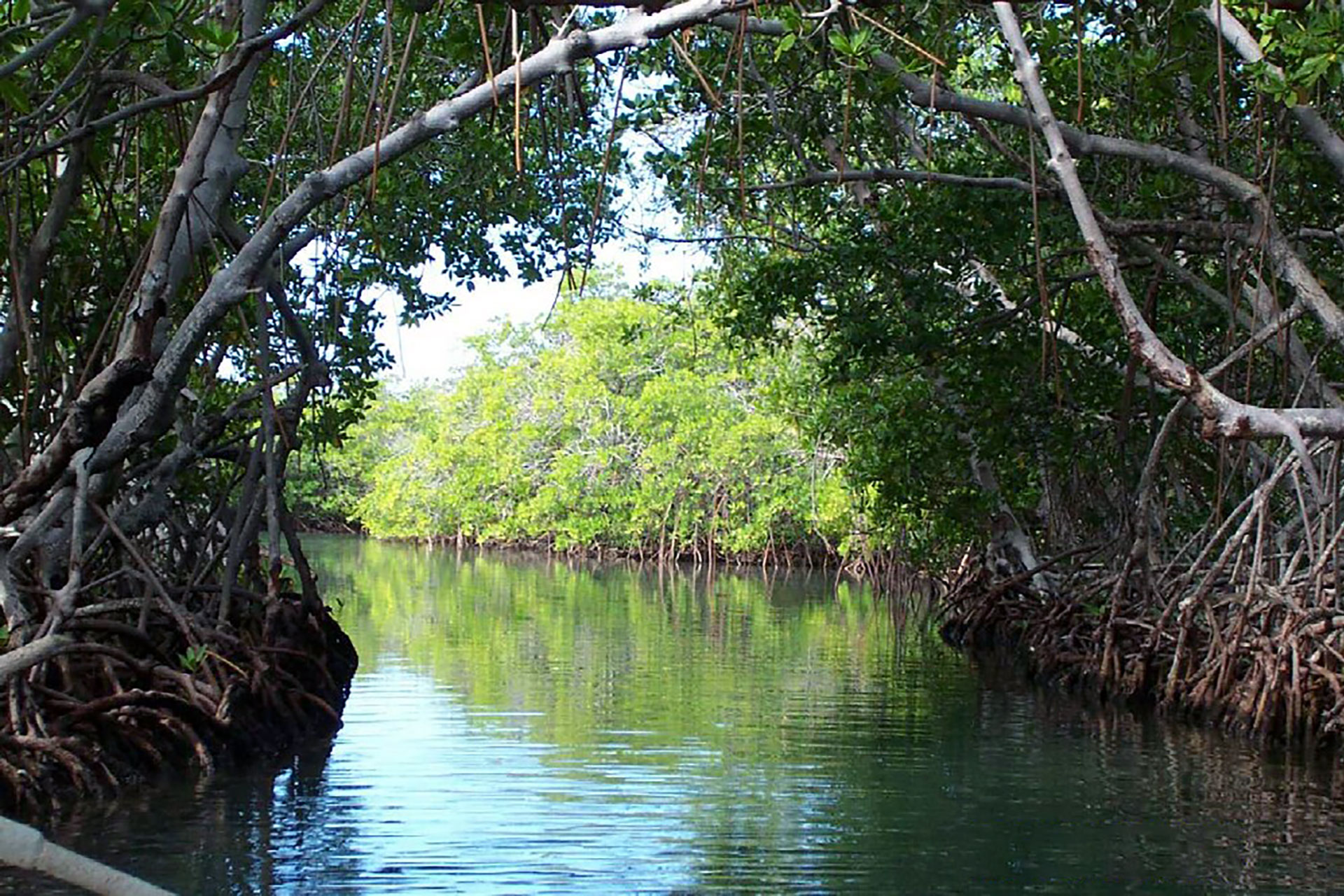
Lajas is located in Puerto Rico's Southwest Region, bordered by San Germán to the north, Cabo Rojo to the west, Guánica to the east, and the Caribbean Sea to the south. Covering nearly 60 square miles, the municipality stretches from fertile inland valleys to one of the island's most ecologically important coastal ecosystems.
The municipality is best known for La Parguera Natural Reserve, an extensive network of mangrove forests, cays, coral reefs, seagrass beds, and shallow turquoise waters that support abundant marine life. Offshore are dozens of small islands (cayos), including Mata La Gata, Caracoles, Enrique, and Majimo, making Lajas one of Puerto Rico's premier boating and snorkeling destinations.
Neighborhoods & Barrios
Lajas is made up of 12 barrios (PDF) (wards/districts):
- Candelaria
- Costa
- Lajas
- Lajas Arriba
- Llanos
- Palmarejo
- Parquera
- Paris
- La Plata
- Pueblo
- Sababa Yeguas
- Santa Rosa
Climate
Lajas enjoys a tropical savanna climate with warm temperatures throughout the year. Thanks to its location in Puerto Rico's southwest, it is one of the island's driest municipalities, receiving less annual rainfall than most other regions. Average daytime temperatures range from 82°F to 91°F (28°C to 33°C), while evenings are typically comfortable, especially during the winter months.
The dry climate makes Lajas an excellent destination for outdoor activities year-round, including boating, kayaking, snorkeling, fishing, hiking, and exploring the nearby cays. The calm waters around La Parguera are especially popular during the summer, while winter offers pleasant weather with lower humidity.
10 Day Forecast from weather.com
Local Tip
Because Lajas receives less rainfall than much of Puerto Rico, it often enjoys clear skies when other parts of the island are experiencing afternoon showers. This makes it one of my favorite places for sunset cruises, kayaking through the mangroves, and evening trips to the famous bioluminescent bay in La Parguera.
There are many well-known "lajeños", among them: first Puerto Rican Cardinal Luis Aponte Martinez.
Where to Stay
- Parador Villa Parguera
- Turtle Bay Inn
- Nautilus by La Jamaca
- La Jamaca
- Posada Porlamar
- Parguera Plaza Hotel
- Beachfront villas
- Airbnb properties
Local Flavors & Festivities
Where to Eat
- La Casita
- Restaurante Puerto Parguera
- Los Balcones
- Moon's Bar & Tapas
- Isla Cueva
- Pescadería Mar Azul
- Coffee Spot
- Sweet & Salty
- Panadería Valle
- La Francesa Panadería
- Panadería La Estación
Festivals and Events
Displaying 5 results.
- Feria Agricola de la Reserva del Valle - September
- Feria Agropecuaria - June
- Festival de Chiringas - February
-
Fiestas Patronales de Nuestra Senora de la Candelaria
- February
Every year, Lajas celebrates a patron saint festival. The festivities include dances, food, parades and religious processions.(787) 899-1450
- Lola Rodriguez de Tio Festival - September
Moments in History
The region was inhabited by the Taíno people, who relied on the area's mangroves and coastal waters.
Lajas becomes an independent municipality, founded by Teodoro Jácome Pagán.
Agriculture, particularly sugar cane and livestock, drives the local economy.
La Parguera develops into one of Puerto Rico's premier recreational boating destinations.
Lajas is internationally recognized for its bioluminescent bay, marine ecosystems, and ecotourism.
Notable People
Despite its small size, Lajas has produced influential leaders, artists, educators, athletes, and public servants who have helped shape Puerto Rico's culture, politics, and history. Their achievements reflect the town's proud heritage and its lasting contributions to the island.
Famous Lajeños
Segundo Ruiz Belvis
1829–1867
Abolitionist • Lawyer
One of Puerto Rico's leading advocates for the abolition of slavery and civil rights.
Antonio Fas Alzamora
1948–Present
Politician • Attorney
Former President of the Puerto Rico Senate.
Ramón Ortiz del Rivero
1932–2010
Baseball Player
Former Major League pitcher.
Silvia Rexach
1922–1961
Composer • Singer • Poet
One of Puerto Rico's most celebrated composers, Silvia Rexach wrote dozens of beloved boleros, including Olas y Arenas and Mi Último Fracaso. Her music remains an important part of Puerto Rican popular culture.
City Symbols
Lajas' official symbols celebrate its agricultural heritage, coastal beauty, and centuries of local history. Together, the flag, coat of arms, and municipal anthem reflect the identity and traditions of one of Puerto Rico's most picturesque towns.
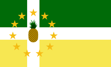
Flag
The Flag of Lajas features green and white horizontal fields, symbolizing the municipality's fertile valleys, agricultural traditions, and peaceful character. At its center appears the municipal coat of arms, representing the town's history and civic identity.
Green represents the rich farmland that has sustained Lajas for generations, while white symbolizes peace, integrity, and the community's welcoming spirit.
Coat of Arms
The Coat of Arms of Lajas incorporates symbols representing the municipality's founding and natural environment.
Notable elements include:
- A silver tower, honoring the town's historical heritage and strength.
- Crosses, reflecting the Spanish colonial roots and Christian traditions associated with the municipality's founding.
- Agricultural imagery, recognizing Lajas' fertile valley and its importance as one of Puerto Rico's principal farming regions.
- Green and silver colors, symbolizing the fertile plains and purity of the community.
The shield is crowned with the traditional five-tower mural crown used by Puerto Rican municipalities, representing Lajas' status as an incorporated town.
Anthem
The municipal anthem celebrates Lajas' natural beauty, rich agricultural lands, and the warm hospitality of its people. The lyrics pay tribute to the fertile Lajas Valley, the fishing village of La Parguera, and the pride residents have for their hometown.
Frequently performed during civic celebrations and the Fiestas Patronales, the anthem reflects the community's strong connection to its history, traditions, and coastal landscape.
Nuestro Lajas, pueblito querido...
Human & Capital Resources
Economy
Lajas has long been recognized as one of Puerto Rico's most important agricultural municipalities. The fertile Lajas Valley supports the cultivation of plantains, bananas, vegetables, grains, and tropical fruits, while cattle ranching and dairy farming continue to play an important role in the local economy. In recent decades, tourism has become another major economic driver, particularly in La Parguera, where boating, fishing, ecotourism, waterfront restaurants, and the world-famous bioluminescent bay attract visitors year-round. Small businesses, hospitality, retail, and public services also contribute to the municipality's growing and diverse economy.
Education
There are 12 public schools in Lajas, education is handled by the Puerto Rico Department of Education.
Demographics *
Population
23,386
Land Area: 59.95 sq mi
Density: 373.5 per sq mi
Median Age: 46.3
Sex: 51% female
Economics **
$8,251
Median household income: $14,439
Puerto Rico: $21,058
Persons below poverty line: 61.4%
Housing, families and educational attainment *
Number of households
7,933
Housing units density:
206.8 (2013)
Persons per household: 2.82
High school grad or higher: 66.2%
Marital status: 38% married
* U.S. Census Bureau 2020 data, unless otherwise noted - Source: Quick Facts Puerto Rico.
** U.S. Census Bureau 2016-2020
Map References
Coordinates: 18.0519° N, 67.0597° W
ZIP Code: 667
Driving Distance from San Juan: 111.6 miles
Driving Time: 2 hours, 28 minutes
Did You Know?
Puerto Ricans have voted in five referendums on the issue of statehood, in 1967, 1993, 1998, 2012 and 2017.
This is your comprehensive guide to La Isla del Encanto.