Canóvanas, Puerto Rico
(kah-NO-vah-nahs)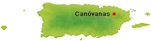
Canóvanas is known as "La Cuna de los Indios" (Indian cradle) and "La Ciudad de las Carreras" (race horse town) because of its racetrack call "El Comandante". Juan R. Calderón founded Canóvanas in 1909. Canóvanas derives its name from a local Indian chief Canobaná (Canovanax).
Canóvanas is also known as the "Pueblo Valeroso" (valiant town) because the local Indian chief Yuira was killed defending the Spaniards from the Taínos.
Located about a 15-minute drive from Luis Muñoz Marín International Airport the Hipódromo Camarero (formerly known as El Nuevo Comandante) is the only race track in Puerto Rico, holding horse races every Monday, Wednesday, Friday, Saturday and Sunday. Admission and parking are free. (787) 886-5151, (787) 641-6060.
Other places worth exploring include:
- Los Pilones Falls
- Charco de los Caballos
Economy
The surrounding areas produce coffee, sugar cane and bananas.
Geography
Canóvanas is located in the northeastern region, north of Juncos and Las Piedras; south of Loíza; east of Carolina; and west of Río Grande. Its rivers are: Canóvanas, Cubuy, Herrera, Canovanillas and Grande de Loíza.
To the south of Canovanas you'll find portions of the Luquillo Mountain Range, with the Cerro El Negro being the highest peak in the region at 2,592 feet. Other high peaks include La Peregrina (1,903 feet) and Pitahaya (951 feet), both located at Barrio Hato Puerco.
Canovanas is made up of 8 barrios (PDF) (wards/districts):
- Campo Rico
- Cubuy
- El Verde
- Hato Puerco
- Las Lomas
- Las Mercedes
- Pueblo
- Toma Agua
Climate
The annual precipitation is approximately 73.62 inches and the average temperature is 75°F.
Notable People
There are many well-known "canovanenses", among them:
- Franciso E. Mundo
- Enrique Sanchez Cappa
- Julio Jimenez
- Luis Sanchez Cappa
- Rafael Albandoz
- Agustin Lopez Cases
- Milagros Carillo ("La jibarita de Canovanas")
Restaurants
- Tropical Hong Kong Restaurant (Chinese), (787) 876-6111
- Tropical Hong Kong Restaurant (Chinese), (787) 256-2350
Festivals and Events
- Fiestas de Cruz - May
-
Fiestas Patronales de Nuestra Sra. del Pilar
- October
Every year, Canovanas celebrates a patron saint festival. The festivities include dances, food, parades and religious processions.(787) 876-2328
- Navidad en el Campo - December
Displaying 3 results.
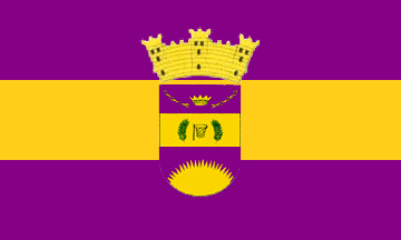
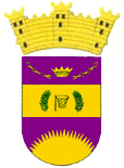
Symbols
Flag
Coat of Arms
Anthem
The anthem of Canovanas was written by Doris Sandra Estrada Jimenez. The title is Canóvanas.
Education
There are 17 public schools in Canovanas, education is handled by the Puerto Rico Department of Education.
Demographics *
Population
42,337
Land Area: 32.87 sq mi
Density: 1,372.70 per sq mi
Median Age: 40.8
Sex: 52% female
Economics **
$13,610
Median household income: $21,614
Puerto Rico: $21,058
Persons below poverty line: 41.3%
Housing, families and educational attainment *
Number of households
14,705
Housing units density:
592.5 (2013)
Persons per household: 3.06
High school grad or higher: 76.1%
Marital status: 40% married
* U.S. Census Bureau 2020 data, unless otherwise noted - Source: Quick Facts Puerto Rico.
** U.S. Census Bureau 2016-2020
Map References
Coordinates: 18.3792° N, 65.9014° W
ZIP Code: 00729, 00745
Driving Distance from San Juan: 10.7 miles
Driving Time: 22 minutes
Did You Know?
More people of Puerto Rican origin (an estimated 5.6 million) live in the mainland United States than in Puerto Rico.
This is your comprehensive guide to La Isla del Encanto.