
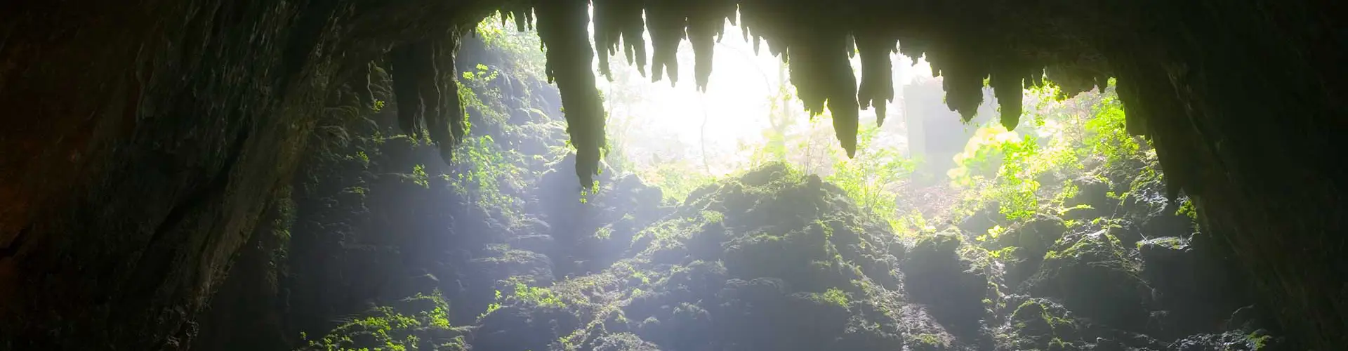
Camuy, Puerto Rico
(kahm-WEE)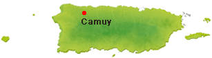
Camuy is known as "La Ciudad Romántica" (romantic city) and "La Ciudad del Sol Taíno" (city of the Taino sun). The town was founded in 1807, when it was disassociated from Arecibo by Petrolina Matos.
It is said that Camuy derives its name from a word used by the Indians "camuy", which means sun, at the same time others think that it was the name that the Indians gave to the river that crossed this region.
Overview
Why Visit Camuy?
Camuy offers one of Puerto Rico's most dramatic natural experiences: the Río Camuy Cave Park, a vast limestone cave system carved by an underground river. Known as La Ciudad Romántica and La Ciudad del Sol Taíno, Camuy combines natural beauty, Taíno heritage, quiet north coast beaches, and small-town charm. It is an ideal stop for travelers exploring Puerto Rico's North Region, especially those interested in caves, rivers, photography, geology, and a slower, more local side of the island.
Top Things to Do in Cabo Rojo
Río Camuy Cave Park
One of Puerto Rico's most spectacular natural attractions, Río Camuy Cave Park protects part of a vast limestone cave system carved over millions of years by the Camuy River, one of the world's largest underground rivers. Covering more than 260 acres, the park features enormous caverns, towering sinkholes, underground rivers, and dramatic rock formations shaped by water over countless centuries.
Visitors descend into a lush sinkhole before entering cathedral-like chambers filled with massive stalactites, stalagmites, and natural columns. Sunlight filtering through the cave openings creates one of the island's most breathtaking natural scenes. The cave system is also home to several species of bats and unique cave-adapted wildlife, including blind fish and invertebrates that have evolved in complete darkness.
Although scientists estimate the entire cave system extends for more than 10 miles (16 km), only a portion has been explored and is accessible to visitors. The park continues to be an important destination for geological, hydrological, and biological research.
Book a Tour to Rio Camuy Cave Park (Parque Nacional de las Cavernas del Río Camuy)
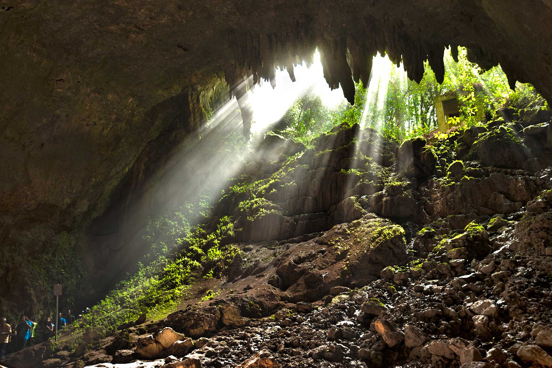
Cueva Clara
The highlight of the park is Cueva Clara, an immense chamber measuring approximately 695 feet (210 m) in length. Its soaring ceilings, giant limestone formations, and dramatic shafts of natural light make it one of Puerto Rico's most photographed natural attractions.
Walking through the cave reveals millions of years of geological history, with mineral deposits slowly creating stalactites hanging from the ceiling and stalagmites rising from the cave floor. During rainy periods, visitors can also hear the Camuy River flowing deep beneath the cave system.
Sumidero Tres Pueblos
This impressive sinkhole marks part of the underground route of the Camuy River and connects the municipalities of Camuy, Hatillo, and Lares. It is one of the most significant natural features associated with the cave system.
Playa Peñón Brusi
Camuy's best-known beach, Playa Peñón Brusi, is a relaxed local favorite named after the large rock formation found near the water. It is known for its tidal pools, family-friendly atmosphere, and laid-back north coast scenery. During low tide, shallow pools form along the shore, making it a pleasant place to relax and enjoy the ocean views.
Hacienda Morell
A historic property connected to Camuy's agricultural past, Hacienda Morell reflects the municipality's rural heritage and the role farming once played in shaping the local economy.
Lago Guajataca
Although technically located along the border of San Sebastián, Isabela, and Quebradillas, Lago Guajataca is one of the area's most popular natural attractions and is only a short drive from Camuy. Created in 1929 by the construction of Guajataca Dam, the reservoir stores approximately 11 billion gallons of water and supplies drinking and irrigation water to several municipalities in northwestern Puerto Rico. Today the lake is popular for fishing, kayaking, birdwatching, and enjoying the surrounding karst landscape.
Additional Places to Explore
Playa Peñón Amador
A quieter beach area known for coastal views, sunsets, and a more local atmosphere. It is a good choice for visitors who want to enjoy Camuy's shoreline away from busier tourist beaches.
Camuy Pueblo
The town center offers a traditional Puerto Rican plaza, local shops, churches, bakeries, and small restaurants. It is a nice stop before or after visiting the caves.
Camuy River
The river is central to the municipality's identity and helped shape the cave system that made Camuy famous. Its underground course is one of the most fascinating natural features in Puerto Rico.
Membrillo Coastal Area
Located near Playa Peñón Brusi, this coastal sector offers access to the beach, local food spots, and relaxed oceanfront scenery.
Iglesia de Piedra (Stone Church)
Built in 1912, Iglesia de Piedra (officially the Ernesto Memorial Chapel) is one of Puerto Rico's most unusual historic churches. Constructed entirely by hand using local limestone gathered by residents, the chapel was built as a memorial to Ernesto Kiplinger, the young son of an American missionary family. Despite having no visible structural columns and surviving more than a century of hurricanes and earthquakes, the church remains remarkably intact. Today it is listed on the National Register of Historic Places and continues to serve both as an active church and a popular architectural landmark.
Paseo Tablado del Río Camuy
A pleasant riverside boardwalk overlooking the Camuy River, ideal for a relaxing walk through town.
Museo Histórico de Camuy
Learn about the municipality's Taíno heritage, agricultural traditions, and local history.
Hacienda Morell
A historic estate reflecting Camuy's agricultural past and colonial heritage.
Peñón Brusi Beach
One of Camuy's favorite local beaches, known for its rocky shoreline, tidal pools, and spectacular sunsets.
Plan your Visit
Situated on Puerto Rico's scenic southwest coast, Cabo Rojo is best explored by car.
Getting There
By Car
Located on Puerto Rico's northwestern coast, Camuy is best explored by car. The municipality is easy to combine with nearby destinations such as Arecibo, Hatillo, Quebradillas, and Lares.
From Aguadilla
Travelers flying into Rafael Hernández International Airport (BQN) can reach Camuy in about 45–60 minutes, depending on traffic and route.
Getting Around
Rental Car
A rental car is recommended. The caves, beaches, town center, and nearby attractions are spread across the municipality and surrounding region.
Walking
Camuy Pueblo is walkable around the town plaza, but most natural attractions and beaches require driving.
Local Tip
If you plan to visit Río Camuy Cave Park, check the park's current operating status and hours before driving there. Access has changed over the years due to weather damage, repairs, and reopening
Nature & Resources
Geography
Camuy territory is mostly flat because the city it is located on the Valley of Quebradillas, bordering the Atlantic Ocean, north of Lares; east of Quebradillas; and west of Hatillo.
Camuy is crossed by the Camuy and Cibao rivers, whose waters have shaped the municipality's impressive limestone landscape and extensive cave systems, including the world-famous Camuy River Cave Park.
Neighborhoods & Barrios
Camuy is divided into 13 barrios (PDF), each contributing to the municipality's rural, coastal, and historic character.
- Abra Honda
- Camuy Arriba
- Ciénagas
- Cibao
- Membrillo
- Piedra
- Gorda
- Pueblo Puente
- Puertos
- Quebrada
- Santiago
- Yeguada
- Zanja
Climate
Camuy enjoys a tropical climate with warm temperatures throughout the year, averaging between 74°F and 88°F (23°C to 31°C). The municipality experiences abundant sunshine, refreshing trade winds, and moderate rainfall, with the wettest months typically occurring from May through November. Thanks to its location along Puerto Rico's northern coast, visitors can enjoy beautiful weather for exploring attractions such as Camuy River Cave Park, beaches, and scenic limestone landscapes during any season. The cooler, drier months from December through April are especially popular for outdoor adventures and sightseeing.
Where to Stay
Camuy has fewer large hotels than nearby tourist centers, so many visitors stay in nearby Arecibo, Hatillo, Quebradillas, Isabela, or Aguadilla and visit Camuy as part of a north coast day trip.
Small inns, guesthouses, and vacation rentals are available throughout Camuy and nearby coastal areas.
Arecibo, Isabela, and Aguadilla offer more hotel options while keeping Camuy within easy driving distance.
Local Flavors & Festivities
Where to Eat
Camuy's dining scene is relaxed and local, with casual Puerto Rican restaurants, bakeries, and beachside food spots near the coast.
- El Fogón de Abuela
- Puerta Criolla
- Sabor Boricua
- Kosta at Brusi
- Ohana
- Backyard Açai
- Humos de Carbón
- Flor del Café
- Repostería Artesanal Laura
- Panadería El Cafetal
- Artisan Bakery Bistro & Coffee Shop
- Coffee Drive
Festivals and Events
Displaying 10 results.
-
Balseada del Río Camuy
- March
Annual river race and recreation event featuring kayaks, rafts, canoes, and family-friendly activities along the Camuy River.
-
Camuy Summer Fest
- July
Municipal summer celebration with concerts by popular Puerto Rican artists, food kiosks, family entertainment, and activities held in the town center.
-
Carnaval Camuyano
- February
Annual pre-Lenten carnival with colorful parades, carnival queens, vejigantes, live music, kiosks, amusement rides, and family entertainment in downtown Camuy.(787) 898-2160
-
Feria de la Cultura
- September
Annual cultural fair celebrating Camuy's history and heritage with artisan exhibits, folkloric performances, local cuisine, educational displays, and live entertainment.
-
Festival de la Balseada
- September
Community festival celebrating the historic Camuy River rafting tradition with recreational activities, cultural presentations, music, and family entertainment.
-
Festival del Mondongazo
- February
Popular culinary festival celebrating Puerto Rico's traditional mondongo stew with local food vendors, live music, artisan exhibits, and family activities.
-
Festival Playero Penon Brusi
- July
Beach festival at Penon Brusi featuring live music, beach sports, food kiosks, artisan vendors, and family activities along Camuy's coastline.
-
Festival Reviviendo Nuestras Tradiciones
- June
Celebration of Puerto Rican traditions featuring folkloric music, dance, artisan demonstrations, traditional cuisine, and cultural exhibitions.
-
Fiestas Patronales de San Jose
- March
Every March Camuy honors its patron saint, San Jose, with concerts, carnival rides, artisan kiosks, religious processions, parades, traditional foods, and family entertainment in the town plaza.
-
Velorio de Reyes
- January
Traditional Three Kings celebration dating back more than a century, featuring a Rosary in Song, live jíbaro music, artisans, traditional foods, and a community gathering honoring the Epiphany.(787) 898-2160
Moments in History
Taíno communities lived throughout the region, using the rivers, fertile land, and nearby coast for farming, fishing, and daily life.
Camuy is founded after being separated from Arecibo. The town's name is believed to come from a Taíno word associated with the sun or with the river that crossed the region.
Agriculture becomes central to Camuy's economy, with sugarcane, cattle, dairy production, and other rural industries shaping the municipality.
Puente Camuy, a bridge over the Camuy River, connects Camuy with Hatillo and strengthens travel and commerce along the north coast.
The Río Camuy cave system becomes one of the municipality's most recognized natural landmarks, attracting explorers, scientists, and visitors interested in Puerto Rico's karst landscape.
Río Camuy Cave Park opens to the public, becoming one of Puerto Rico's most famous eco-tourism attractions.
Camuy is known for its caves, north coast beaches, Taíno heritage, and relaxed rural character, making it one of the most distinctive destinations in Puerto Rico's North Region.
City Symbols
Camuy's official symbols celebrate the municipality's natural beauty, agricultural heritage, and the strong sense of pride shared by its residents. The flag, coat of arms, and anthem honor Camuy's history, traditions, and its place along Puerto Rico's northern coast.
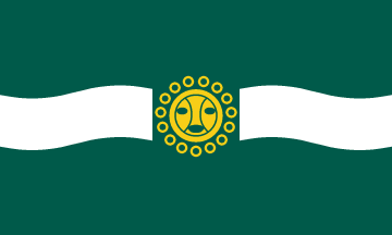
Flag
The flag of Camuy features a green field crossed by a white wavy horizontal band, symbolizing the Camuy River, one of Puerto Rico's most important waterways and the force behind the island's famous Río Camuy Cave System. At the center is the municipal emblem, representing the city's history and civic identity. The green color reflects Camuy's fertile landscapes, forests, and agricultural traditions, while the white symbolizes peace, purity, and the river that has shaped the municipality for centuries.
Coat of Arms
The coat of arms of Camuy incorporates symbols representing the municipality's history, geography, and Christian heritage. Its central emblem reflects Camuy's founding and development, while the surrounding decorative elements recognize the municipality's agricultural traditions and the natural resources that have sustained the region. Together, the coat of arms symbolizes the resilience, prosperity, and pride of the people of Camuy.
Anthem
The official anthem of Camuy, Pedazo de Borinquen, was written by Ramón "Jovito" Barreto, a beloved local composer and musician. The title, meaning "A Piece of Borinquen," expresses the deep affection Camuy's residents have for their hometown and its place within Puerto Rico.
The lyrics celebrate Camuy's lush countryside, hardworking people, and strong cultural traditions while honoring the municipality's natural beauty, including the fertile valleys, rivers, and dramatic limestone landscapes that define the region. Performed during municipal celebrations, cultural festivals, and official ceremonies, the anthem has become a lasting symbol of civic pride and the enduring spirit of Camuy.
Pedazo de Borinquen (A Piece of Borinquen).
Human & Capital Resources
Economy
Camuy's economy is built on a combination of agriculture, tourism, manufacturing, retail commerce, and small businesses. Agriculture has long been one of the municipality's economic foundations, with local farms producing dairy products, cattle, plantains, vegetables, and tropical fruits. The region is especially known for its dairy industry, which remains an important contributor to Puerto Rico's agricultural economy.
Tourism has become increasingly significant thanks to attractions such as Camuy River Cave Park, one of the world's largest cave systems, along with nearby beaches and natural areas that attract visitors year-round. Retail businesses, restaurants, healthcare services, and family-owned enterprises also provide employment and support the local economy. Together, these industries help preserve Camuy's rural character while creating opportunities for sustainable economic growth.
Education
Camuy offers a variety of public and private schools serving students from elementary through high school. While the municipality does not have a major university campus, residents benefit from convenient access to higher education institutions in nearby municipalities.
Students pursuing college degrees are within a short drive of the University of Puerto Rico at Arecibo (UPRA) and the Inter American University of Puerto Rico – Arecibo Campus, both of which offer undergraduate programs in business, education, science, healthcare, technology, and the liberal arts. Additional technical colleges and vocational schools throughout Puerto Rico's northern region provide workforce training and professional certification opportunities.
With quality local schools and easy access to nearby universities, Camuy offers families a strong educational foundation while maintaining the relaxed lifestyle and natural beauty that make the municipality a unique place to live and visit.
Demographics *
Population
32,827
Land Area: 46.35 sq mi
Density: 670.2 per sq mi
Median Age: 43.3
Sex: 52% female
Economics **
$11,339
Median household income: $18,571
Puerto Rico: $21,058
Persons below poverty line: 45.6%
Housing, families and educational attainment *
Number of households
11,349
Housing units density:
311.3 (2013)
Persons per household: 2.73
High school grad or higher: 72.5%
Marital status: 47% married
* U.S. Census Bureau 2020 data, unless otherwise noted - Source: Quick Facts Puerto Rico.
** U.S. Census Bureau 2016-2020
Map References
Coordinates: 18.4839° N, 66.8450° W
ZIP Code: 627
Driving Distance from San Juan: 63.1 miles
Driving Time: 1 hour, 30 minutes
Frequently Asked Questions
Where is Camuy located?
Camuy is located on Puerto Rico's north coast, about 1½ hours west of San Juan and between Hatillo and Quebradillas.
What is Camuy known for?
Camuy is best known for Río Camuy Cave Park, one of the largest cave systems in the Western Hemisphere, and for its beautiful karst landscape.
What is Río Camuy Cave Park?
Río Camuy Cave Park is a spectacular limestone cave system featuring massive caverns, sinkholes, underground rivers, and Cueva Clara.
Is Río Camuy Cave Park open?
The park has experienced periodic closures and limited operations. Check the official website before visiting for current hours and availability.
What is Cueva Clara?
Cueva Clara is the park's largest accessible cave, known for its enormous chamber, impressive rock formations, and dramatic natural light.
What are the best things to do in Camuy?
Visit Río Camuy Cave Park, explore Cueva Clara, relax at Playa Peñón Brusi, see Iglesia de Piedra, and enjoy the scenic Guajataca area.
What is Playa Peñón Brusi known for?
Playa Peñón Brusi is known for its rocky shoreline, tidal pools, local seafood kiosks, and beautiful sunsets.
How far is Camuy from San Juan?
Camuy is approximately 82 miles (132 km) from San Juan, about a 1½-hour drive.
Do you need a rental car in Camuy?
Yes. A rental car is the best way to explore Camuy's caves, beaches, and nearby attractions.
When is the best time to visit Camuy?
December through April offers the driest weather, making it ideal for cave tours, sightseeing, and enjoying the north coast beaches.
Did You Know?
The number of people living in Puerto Rico decreased by 142,000 (4.4%) from 3,337,000 in 2017 to 3,195,000 in 2018.
Get Our Newsletter
Discover new places, local flavors, upcoming events, cultural stories, and some of our favorite finds from around the island.Read the Latest ¡La Isla! Newsletter
Follow Along


