Patillas, Puerto Rico
(pah-TEE-yahs)
Patillas is known as "La Esmeralda del Sur" (emerald of the south), because of its green mountains. Patillas was founded in 1811.
Patillas is located in the southeastern coast, south of San Lorenzo; west of Yabucoa and Maunabo; and east of Guayama and Arroyo.
The surrounding areas produces sugar cane and oranges.
There are many well-known "patillenses", among them: Angelita Lind.
Patillas is made up of 16 barrios (PDF) (wards/districts):
- Apeadero
- Bajo
- Cacao Alto
- Cacao Bajo
- Egozcue
- Guardarraya
- Jacaboa
- Jagual
- Mamey
- Marín
- Mulas
- Muñoz Rivera
- Pollos
- Pueblo
- Quebrada Arriba
- Ríos
Restaurants
- Cofresi (Puerto Rican), (787) 271-2357
- El Mar De La Tranquilidad (Puerto Rican), (787) 839-6469
- La Esmeralda (Puerto Rican), (787) 839-3058
- Musafa (Sea Food), (787) 929-3395
Fax (787) 839-4326
Accommodations
- Caribbean Paradise Hotel (Parador),
787) 839-5885
- Caribe Playa Beach Resort (Resort),
787-839-6339
- Villa del Carmen (Rental),
(787) 839-7536
- Villas Linda (Villa),
(787) 271-3453
Festivals and Events
-
Carnaval de Patillas
- May
The festivities include dances, food, and parades.(787) 839-4120
-
Festival de Harina
- December
Celebrates traditional flour-based foods and local cuisine.(787) 839-4120
-
Festival del Name
- December
(787) 839-4120
-
Festival Monte y Mar
- July
(787) 839-4120
-
Fiestas Patronales de San Benito Abad
- March
Every year, Patillas celebrates a patron saint festival. The festivities include dances, food, parades and religious processions.(787) 839-4120
Displaying 5 results.
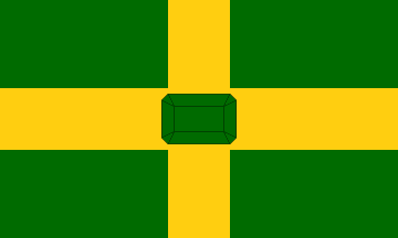
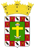
Symbols
Anthem: Patillenses
Education
There are 14 public schools in Patillas, education is handled by the Puerto Rico Department of Education.
Climate
10 Day Forecast from weather.com
Demographics *
Population
15,985
Land Area: 46.7 sq mi
Density: 356 per sq mi
Median Age: 45.7
Sex: 51% female
Economics **
$10,142
Median household income: $17,138
Puerto Rico: $21,058
Persons below poverty line: 50.8%
Housing, families and educational attainment *
Number of households
6,101
Housing units density:
200.4 (2013)
Persons per household: 2.72
High school grad or higher: 76%
Marital status: 40% married
* U.S. Census Bureau 2020 data, unless otherwise noted - Source: Quick Facts Puerto Rico.
** U.S. Census Bureau 2016-2020
Map References
Coordinates: 18.0064° N, 66.0158° W
ZIP Code: 723
Driving Distance from San Juan: 59.6 miles
Driving Time: 1 hour, 31 minutes
Did You Know?
Puerto Rico is home to more than 60 hospitals.
This is your comprehensive guide to La Isla del Encanto.