Geography of Puerto Rico
Location & Size
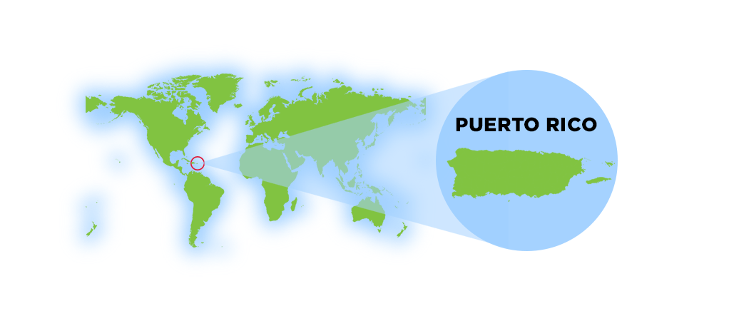
The island of Puerto Rico is a very popular tourist destination because of its location, rich history and warm atmostphere. Puerto Rico is strategically positioned in the northeastern Caribbean Sea.
Geographic Position
Coordinates
Latitude: 18° 15" N Longitude: 66° 30" W
Location
- Easternmost island of the Greater Antilles
- Between the Caribbean Sea and Atlantic Ocean
- 1,000 miles southeast of Miami, Florida
- West of the U.S. Virgin Islands
- East of Hispaniola (Dominican Republic/Haiti)
Region
North America
Subregion
Caribbean
Map References
Central America and the Caribbean
Limits
To the west by Haití and the Dominican Republic (La
Hispañola), separated by the Mona Passage ("Mona Canal"), to
the east by the Virgin Islands, to the north by the Atlantic Ocean, and to the
south by the Caribbean Sea.
Dimensions
Land Area
3,515 sq mi (9,104 sq km)
Roughly the size of Connecticut or three times the size of Rhode Island
Water Area
145 sq km
Island Measurements
- Length: 100 miles (160 km) east to west
- Width: 35 miles (56 km) north to south
- Coastline: 270 miles (435 km)
- Offshore Islands: Over 140 smaller islands
Land boundaries
0 km
Borders
Puerto Rico is under the U.S. customs jurisdiction. Borders are
open between P.R. and the U.S., allowing for free movement of people and
merchandise.
Maritime Claims
Continental shelf: 200 NM (depth)
Exclusive economic zone: 200 NM
Territorial sea: 12 NM
The island is located in the Caribbean, between the Caribbean Sea and the North Atlantic Ocean, east of the Dominican Republic, about 1,000 miles (1,600 km) southeast of Miami, Florida. Puerto Rico is one of the 28 islands in the Caribbean.
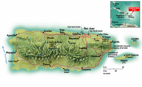
Puerto Rico is almost rectangular in shape, approximately 100 miles long by 35 miles wide and is the smallest and the most eastern island of the Greater Antilles (Cuba, Hispaniola, Jamaica and Puerto Rico).
Although, often referred an island, Puerto Rico is an archipelago formed by the main island and 143 small islands, islets and cays, including Vieques, Culebra, Culebrita, Palomino, Mona, and Monito. Vieques and Culebra are also known by some by the Spanish Virgin Islands, formerly called the Passage Islands and also known as the Puerto Rican Virgin Islands.
Its coasts measures approximately 435 km, and if the adjacent islands Vieques and Culebra are included the coast measures approximately 700 km. With an area of 3,425 square miles (9,104 sq km), Puerto Rico is the third largest island in the United States and the 82nd largest island in the world.
3rd largest island in the U.S. (after Hawaii and Kodiak Island, Alaska)
Atlantic Standard Time (AST), UTC-4 year-round (no daylight saving)
Vieques, Culebra, and Mona Island are the largest offshore territories
~900 people per square mile, one of the most densely populated islands
The maximum length from east to west (from Punta Puerca to Punta Higuero) of 100 miles (160 km) and with a maximum width from north to south (from Isabella to Punta Colón) of 35 miles (56 km).
Source: National Geographic Society
Interesting Fact
Puerto Rico is close to the deepest submarine depression in the
North Atlantic Ocean (second in the world). The Puerto Rico Trench, roughly parallel to the
northern coast of the island of Puerto Rico and lying about 75 miles
(120 km) to the north. The Puerto Rico Trench is about 1,090 miles
(1,750 km) long and 60 miles (100 km) wide. The deepest point in the
Atlantic Ocean, the Milwaukee Depth, lies within the Puerto Rico
Trench, at a depth of 27,493 feet (8,380 meters) in the western end of the trench,
about 100 miles (160 km) northwest of Puerto Rico.
The origin of the trench can be traced back to the beginning of the
Tertiary period. The Puerto Rico Trench appears to be part of a
complex system of sinistral strike-slip faults in the north
Caribbean; the trench seems to have been opened continuously for
about 70 million years. It is partially filled with sediments.
The Caribbean's greatest known depth is Cayman Trench (Bartlett Deep) between Cuba and Jamaica, at approximately 25,216 feet (7,686 meters) below sea level.
Terrain & Topography
Puerto Rico is composed of Jurassic to Eocene volcanic and plutonic rocks, which are overlain by younger Oligocene to recent carbonates and other sedimentary rocks. Most of the caverns and karst topography on the island occurs in the northern Oligocene to recent carbonates. The oldest rocks are approximately 190 million years old (Jurassic) and are located at Sierra Bermeja in the southwest part of the island.
Puerto Rico lies at the boundary between the Caribbean and North American plates. This means that it is currently being deformed by the tectonic stresses caused by the interaction of these plates.
Interesting Fact
70.8% of the world's surface is water, 29.2% is land.
Deep oceans waters fringe Puerto Rico. To the west, the Mona Passage, which separates the island from Hispaniola to the west, is about 80 miles (130 km) wide and more that 3,300 feet (1,000 meters) deep. Off the northern coast in the Atlantic Ocean at the boundary between the Caribbean and North American plates is the Puerto Rico Trench, the largest and deepest trench in the Atlantic. The trench is 800 kilometres (497 mi) long and has a maximum depth of 8,000 metres (26,247 ft) at Milwaukee Deep, which is the deepest point in the Atlantic Ocean. To the south the sea bottom descends to the 16,400 feet (5,000 meters) deep Venezuelan Basin of the Caribbean.
Because of the proximity to the two tectonic plates Puerto Rico experiences an average of five earthquakes (including aftershocks) with a magnitude greater than 1.5 occurring near per day.
Although the vast majority of these earthquakes are too small to be felt by people, but provides evidence that the North American plate is moving westward relative to the Caribbean plate at about two centimeters per year.
Terrain & Soil Classification of Puerto Rico
Puerto Rico's diverse landscape results in a variety of soil types, classified differently depending on the approach used.
Different classification schemes exist for the soils of Puerto Rico. One physiographic approach, based on a scientific classification by the U.S. Soil Conservation Service, can be summarized into five general soil types: humid coastal plains, semiarid coastal plains, humid uplands, semiarid uplands, and humid upland valleys. Another classification by soil scientists at the University of Puerto Rico groups the island's soils into coastal lowlands, alluvium, coastal plains, alluvium in terraces, upland dark, and upland reddish-purple.
Agricultural Potential of Puerto Rico's Soils
Although tropical soils are sometimes seen as infertile and poor for agriculture, Puerto Rico's soil diversity has sustained productive farming for centuries. Certain crops thrive in specific soil types due to drainage, moisture retention, and mineral composition.
Best Crops by Soil Type
- Alluvial (Floodplain) Soils – Ideal for: bananas, plantains, yams, taro, and root crops
- Coastal Plains & Lowlands – Used for: coconuts, citrus fruits, mangoes, and pineapples
- Humid Uplands & Valleys – Perfect for: coffee, cacao, and tobacco
- Semiarid Coastal & Upland Soils – Used for: sorghum, legumes, and livestock grazing
Impact of Deforestation & Soil Erosion
Puerto Rico's mountainous terrain and heavy seasonal rainfall make soil erosion a major environmental concern. Over time, deforestation, urbanization, and agricultural expansion have led to:
- Loss of fertile topsoil, affecting crop productivity.
- Increased sedimentation in rivers, impacting water quality.
- Landslides in steep areas, particularly in deforested regions.
To combat these issues, soil conservation efforts such as reforestation programs, contour farming, and terracing are being implemented to preserve the island's agricultural capacity and natural ecosystems.
Regions & Landscape
Mountains
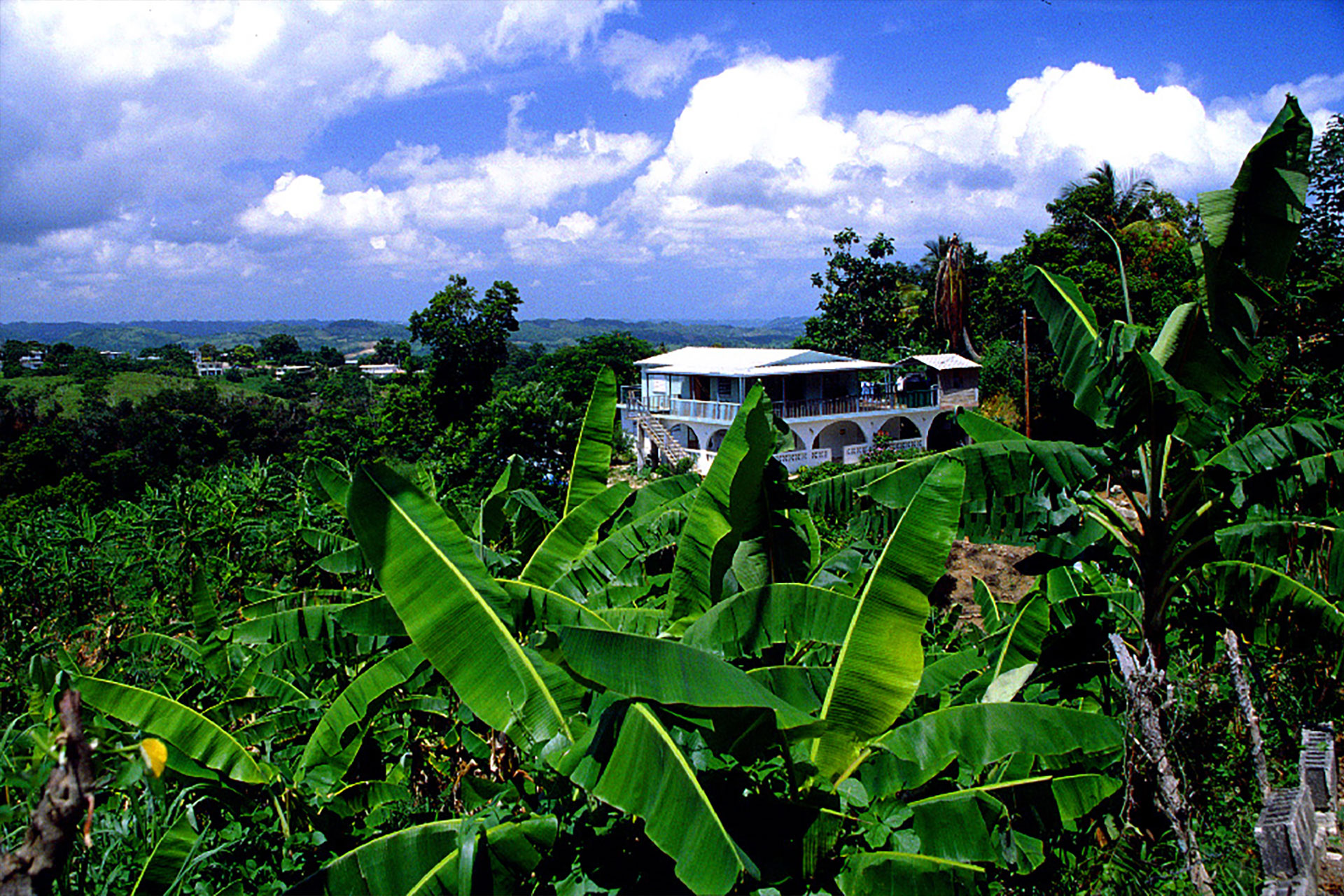
The territory is very mountainous (covering about 60%), except in the regional coasts, but Puerto Rico offers astonishing variety: rain forest, deserts, beaches, caves, oceans and rivers. Puerto Rico has three main physiographic regions: the mountainous interior, the coastal lowlands, and the karst area.
The mountainous interior is formed by a central mountain chain commonly known as the Cordillera Central, extending across the interior of the island, from Mayagüez to Aibonito, which transects the island from east to west. These mountain ranges are La Cordillera Central, La Sierra de Cayey, La Sierra de Luquillo, and La Sierra Bermeja.
Highest Peaks
- Cerro de Punta: 4,390 ft (1,338 m) in Jayuya - Highest point
- Monte Jayuya: 4,314 ft (1,315 m) found between Jayuya and Ciales
- Cerro Rosa: 4,134 ft (1,260 m) in Jayuya
- Piedra Blanca: 4,108 ft (1,252 m)
- Guilarte: 3,953 ft (1,205 m) in Adjuntas
- Tres Picachos: 3,950 ft (1,204 m) in Jayuya
- Maravilla: 3877 ft (1,182 m) in Ponce
Toward to the northeast is Sierra de Luquillo, whose highest peaks are: Toro Hill (1,074 m) found between Río Grande, Naguabo and Las Piedras, and El Yunque Peak (1,065 m) found in Río Grande. Another mountain chain is the Sierra de Luquillo in the northeast.
Coastal Plains
The coastal lowlands extend about 13 to 19 km (8 to 12 mi) inland along the northern coast and 3 to 13 km (2 to 8 mi) along the southern coast. A series of smaller valleys lie perpendicular near the west and east coasts. This region was originally formed by the erosion of the island's interior mountains.
Coastal Features
- North Coast: Atlantic-facing beaches and karst limestone formations
- South Coast: Drier Caribbean-facing coast with mangroves
- East Coast: Palm-lined beaches and El Yunque rainforest
- West Coast: Rugged cliffs and coastal valleys
Karst Region
Another important physiographic feature is the karst region in northern Puerto Rico. This area consists of rugged limestone formations that have been dissolved by water over geological time. The landscape is characterized by extensive mogotes (haystack hills), sinkholes, caves, and limestone cliffs. The karst belt extends from Aguadilla in the west to Loíza just east of San Juan.
Unique Geological Features
Bioluminescent Bays
Bioluminescent bays, also known as phosphorescent bays, are among the rarest natural wonders in the world. Of the five known year-round bioluminescent bays globally, three are in Puerto Rico—making the island one of the best places on Earth to witness this magical glow.
- Mosquito Bay
Located in Vieques, Mosquito Bay has the highest concentration of dinoflagellates, making its glow the most intense and breathtaking of all bio bays. It holds the Brightest Bioluminescent Bay in the World record (Guinness World Records) - Laguna Grande
Located in Fajardo, this mangrove-surrounded lagoon is easily accessible from San Juan and is a popular choice for kayaking tours. It is Puerto Rico's Only Bioluminescent Lagoon. - La Parguera
Located in Lajas, unlike other bio bays where swimming is restricted, La Parguera allows visitors to swim in the glowing waters. Boat tours and snorkeling experiences are also available.
Discover the Magic of Puerto Rico's Bioluminescent Bays
El Yunque National Forest is the only tropical rainforest in the U.S. National Forest System, known for its lush landscapes, waterfalls, hiking trails, and rich biodiversity.
Guánica State Forest
Guánica State Forest is one of the world's best-preserved subtropical dry forests, home to unique wildlife, cactus-covered landscapes, and miles of scenic trails along Puerto Rico's southwest coast.
Mona Island
Another unique environment can be found on Mona Island, 50 miles off the west coast of Puerto Rico. Like the Galapagos Islands, this untouched island has species which are not found elsewhere. Mona is a protected island, under the management of the United States National Park Service and the Puerto Rican Natural Resources Department. Accessible by a sometimes difficult, long boat ride, the island is available for sport diving to those who make special arrangements and are willing to rough it out.
The island's geography also creates regional climate variations—from the lush rainforests of El Yunque to the dry coastal environment of Guánica.
Forest Ecosystems
Puerto Rico's forests protect some of the island's most important natural landscapes—from lush tropical rainforests and cool mountain forests to mangroves and dry coastal ecosystems. The most famous is El Yunque National Forest, the only tropical rainforest in the U.S. National Forest System, known for its waterfalls, dense vegetation, and unique wildlife. Together, these protected forests preserve biodiversity, supply fresh water, and offer visitors incredible opportunities to explore nature.
Explore Puerto Rico's forests and nature reserves
Caves and Caverns
Puerto Rico's northern karst region hides one of the most extensive cave systems in the Western Hemisphere. Underground rivers, massive limestone caverns, sinkholes, and ancient Taíno petroglyphs make these caves both natural wonders and historical treasures.
The most famous system is Río Camuy Cave Park, home to one of the world's largest underground rivers and dramatic cathedral-like caverns carved over millions of years.
Explore Puerto Rico's caves and underground landscapes
Interesting Fact
The islands of Cayo Diablo, St. Thomas, St. John, Tortola,
Guana, Greater Camanoe, Necker Cay, and Virgin Gorda
were once known as the Puerto Rico Bank.
Rivers, Lakes and Water Systems
Puerto Rico's rivers, reservoirs, and coastal lagoons form an important part of the island's geography. More than 1,200 bodies of water are found across Puerto Rico, with about 50 classified as rivers. Most originate in the island's central mountain range, La Cordillera Central, flowing north toward the Atlantic Ocean or south toward the Caribbean Sea.
While Puerto Rico does not have large natural lakes, the island relies on a network of reservoirs created by damming rivers to provide drinking water, irrigation, and hydroelectric power. Coastal lagoons and wetlands also support important wildlife habitats and marine ecosystems.
Explore Puerto Rico's rivers, reservoirs, and coastal lagoons
Natural Resources & Land Use
- Copper, nickel, iron ore deposits
- Limestone and marble
- Salt from coastal areas
- Clay and sand
- Hydroelectric potential
Arable land: 6.6%
Permanent crops: 5.6%
Permanent pasture: 9.8%
Forest: 63.2%
Other: 14.8% (2018 est.)
- El Yunque National Forest
- 19 state forests
- Multiple nature reserves
- Marine protected areas
- Wildlife refuges
Irrigated Land
220 sq km (latest available estimate, 2012)
Natural Hazards:
Periodic droughts; hurricanes
Environment Current Issues
Erosion; occasional drought has
caused water levels in reservoirs to drop and has prompted water rationing.
Many small rivers and high central mountains ensure land is well watered; south coast relatively dry; fertile coastal plain belt in north.
Note: important location along the Mona Passage - a key shipping lane to the Panama Canal; San Juan is one of the biggest and best natural harbors in the Caribbean.
Flora and Fauna
Puerto Rico's diverse landscapes—from tropical rainforests and mountain forests to coastal wetlands and dry forests—support a rich variety of plant and animal life. The island is home to thousands of tropical plant species and unique wildlife, including the famous coquí frog and the endangered Puerto Rican parrot found in the forests of El Yunque.
Discover Puerto Rico's native plants, wildlife, and ecosystems
Climate & Weather
Puerto Rico enjoys a tropical marine climate with warm temperatures year-round and cooling trade winds from the east. Average temperatures range from the mid-70s°F to the upper-80s°F (24–31°C), with wetter months typically occurring from May through October and drier conditions during the winter.
Temperature
Average High: 85°F (29°C)Average Low: 73°F (23 °C)
Rainfall
South Coast: (Driest)30 inchesCoastal: Average60 inches
El Yunque: (Wettest)180+ inches
Hurricane Season
une 1 - November 30 is the official Atlantic hurricane season, with peak activity from August to October.Best Time to Visit
- Winter (Dec-Apr): Peak season, dry and comfortable
- Spring (Apr-May): Great weather, fewer crowds
- Summer (Jun-Aug): Hot, more rain, good for beaches
- Fall (Sep-Nov): Hurricane season, lowest prices
Hurricane Season in Puerto Rico
Hurricanes and tropical storms are part of Puerto Rico's climate, especially during late summer and early fall.
Learn more about Puerto Rico's weather patterns and hurricane season
Time Zone: Atlantic Standard Time (AST), which is one hour later (+1) than Eastern Standard Time (EST) and four hours earlier (-4) than Greenwich Mean Time (GMT). Puerto Rico does not observe Daylight Savings Time.
Atlantic Standard Time (AST, GMT-4, Zone Q), which comprises Puerto Rico and the U.S. Virgin Islands.
The time in Puerto Rico is: 9:38 PM
Sunrise/Sunset Average: 6:54 am to 6:21 pm
Because of the latitude of Puerto Rico the sun is high overhead all year,
there are no great variations from day to day between the times of sunrise and
sunset.
Interesting Fact
Spanish or Castilian (español or castellano) is, like
French, Portuguese, Italian, an Iberian Romance language, derived from Latin. Spanish
is a phonetic language, words are pronounced exactly as they are spelled.
Other Resources
- Iguana de Mona (Photo source: Iguana)
- 1992 Census of Agriculture [PDF]
- National Weather Service Forecast Office - San Juan, PR
- Puerto Rico Perspectives (Cartographic maps)
- Current Conditions for Puerto Rico
- NOAA/AOML/Hurrican Research Division
- Puerto Rico
- Puerto Rico, Virgin Islands - Latest conditions, forecasts by USA Today
- Puerto Rico Trench
- San Juan Weather Report
Sources:
- Dr. Carr, Gerald (Gerry). Department of Botany and Plant Pathology. Retrieved 2020 from http://www.botany.hawaii.edu/faculty/carr/ (offline). (Photos source: poinciana)
Did You Know?
Puerto Rico is one among hundreds of small islands formed approximately 185 million years ago when a large shift of tectonic plates sank some areas and pushed other areas upward forming small islands.


All content included on this website, is not public domain material. The content is the intellectual property of Magaly Rivera or her content providers. Any duplication or distribution of the information contained herein is prohibited without express written permission.
Designed & Developed by Pencils and Pixels