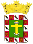
Patillas, Puerto Rico
(pah-TEE-yahs)Patillas is known as "La Esmeralda del Sur" (emerald of the south), because of its green mountains. Patillas was founded in 1811.
Patillas is located in the southeastern coast, south of San Lorenzo; west of Yabucoa and Maunabo; and east of Guayama and Arroyo.
The surrounding areas produces sugar cane and oranges.
There are many well-known "patillenses", among them: Angelita Lind.
Patillas is made up of 16 barrios (wards/districts):
- Apeadero
- Bajo
- Cacao Alto
- Cacao Bajo
- Egozcue
- Guardarraya
- Jacaboa
- Jagual
- Mamey
- Marín
- Mulas
- Muñoz Rivera
- Pollos
- Pueblo
- Quebrada Arriba
- Ríos
Restaurants
-
[an error occurred while processing this directive]
Accommodations
-
[an error occurred while processing this directive]
Festivals and Events
-
[an error occurred while processing this directive]
Symbols
Anthem: Patillenses
Education
There are 14 public schools in Patillas, education is handled by the Puerto Rico Department of Education.


